Today was all about Appenzell – both Ausserrhoden and Innerrhoden. Before we delve into the travels, let’s first have a brief history lesson as to why these are actually two cantons instead of one. When I first looked at the overview of Swiss cantons, I found it rather funny that these are cantons on their own – after all, Appenzell Innerrhoden has fewer inhabitants than the town I live in (and Nyon is not an overly large town). But actually, it’s quite interesting how the two Appenzells got separated.
Appenzell joined the Swiss Confederation in 1513 as one canton, but then the Reformation hit. Whereas the great schism in the Christian church was the reason for many wars and loss of life, it also divided Switzerland, but, at least in the case of Appenzell, very bloodlessly. The people in the outer “Rhodes” (which was simply a term for the districts or communes) majorly leaned towards the Reformation, whereas the people in the inner Rhodes preferred to remain Catholic. As tensions rose, the reformed outer Rhodes in 1597 simply decided to split apart – without any violence, mediated by both Catholic and Reformed judges from other parts of the Confederation. Of course, differences between Catholics and Reformed don’t play a big role anymore nowadays, but over more than 400 years, cantons grow apart and build their own identity, so a reunification is not in sight.
Herisau: Capital of Appenzell Ausserrhoden
My first stop was the capital of Appenzell Ausserrhoden, where I continued to finish my canton parliament selfie challenge. From St. Gallen to Herisau, I had to take a normal gauge train, not operated by the Appenzeller Bahnen which I mentioned yesterday. Herisau is a rather unremarkable town with some old houses and a bit of industry in its surroundings. The canton parliament meets in the building of their cantonal administration quite in the center of the town. There’s not much more to say about this. Maybe it’s interesting to mention though that Herisau is the only train station in both Appenzells which has normal gauge tracks.
A Spontaneous Adventure: Säntis
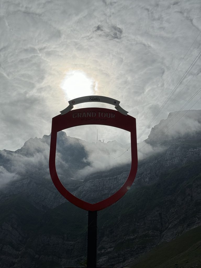
Having finished the Herisau challenge, I had to decide on what to do next. The natural next step would have been to go to Appenzell and directly get the selfie for Appenzell Innerrhoden as well. So I left Herisau from its metric gauge track towards Appenzell and Wasserauen. However, on the way I decided to spontaneously take a cable car up the highest mountain of the Appenzell Alps, the Säntis, which marks the tripoint between both Appenzells and the canton of St. Gallen.
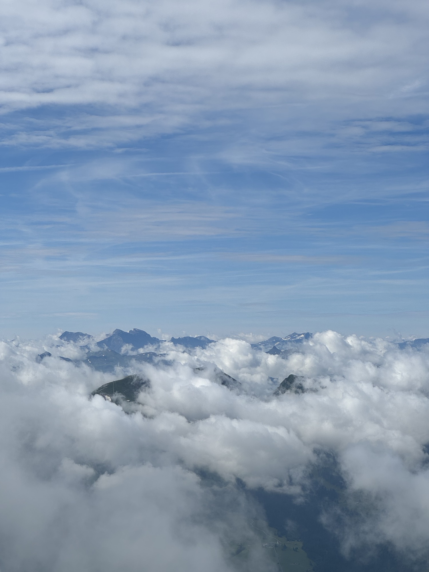
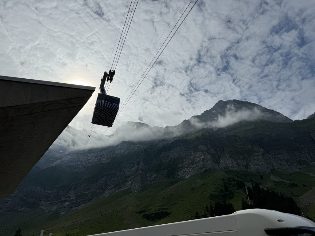
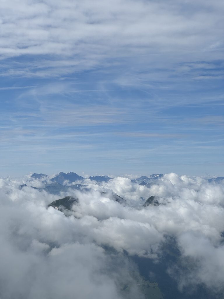
The summit of that mountain measures 2502 m in altitude and is famous for its 6-country view. Allegedly one can view into all neighboring countries of Switzerland under perfect weather conditions – which very rarely occur. From what I saw from the webcam broadcasting live pictures from the summit, I knew I wouldn’t have these perfect conditions, but for sure a spectacular view being above the clouds. So I decided to spend 30 CHF to take the cable car from Schwägalp (reachable by bus from the station of Urnäsch) and get a new altitude record (around 20 meters higher than the Nufenen pass, for those who remember one of the previous blog posts).
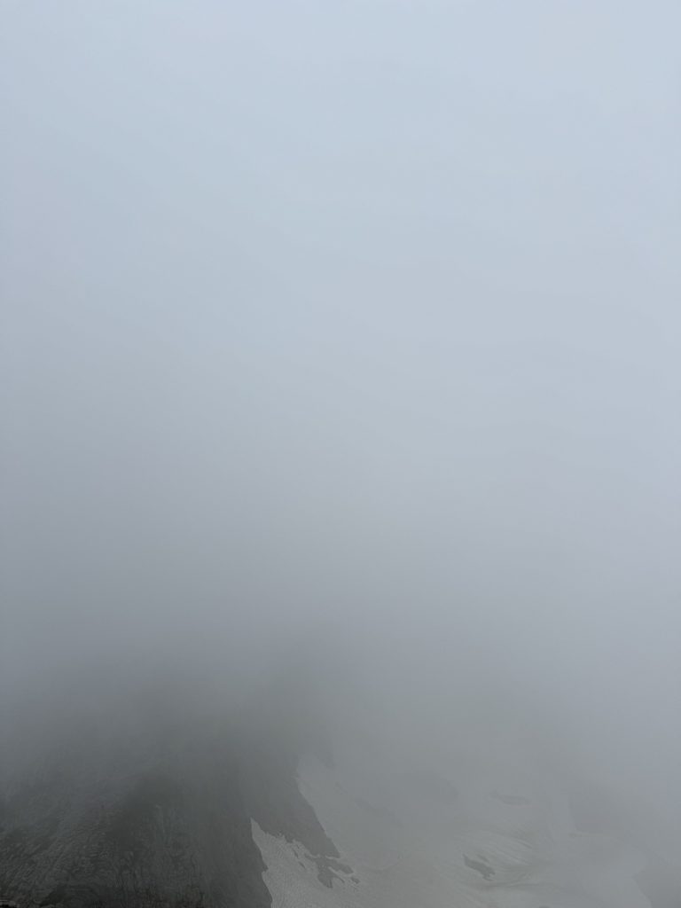
Up there, the view was simply breathtaking. Certainly, under more “perfect” weather conditions one would have seen many more summits, and maybe even all six countries, but with the clouds, the views were even more spectacular. It was almost like on a plane, with the difference that it was way more chilly (as I didn’t plan this in advance, I only wore a T-shirt and shorts) and much quieter. Whereas down in the valley there were still the bells from the cows, up here there was barely any sound apart from the other visitors, which, as I was still early, dispersed quite a bit.
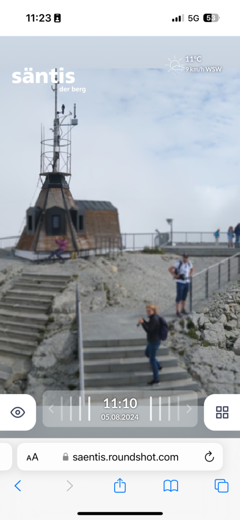
After I took my pictures, and even a very peculiar “selfie” on the public webcam, I had to go inside. Fortunately, the summit is very much made for tourists also in bad weather. There is a whole exhibition about weather and how it has been observed on the Säntis for over 100 years. After a bit over an hour, I went down in an almost empty cable car (even earlier than scheduled as they had to put one extra ride as the demand to go up was so high).
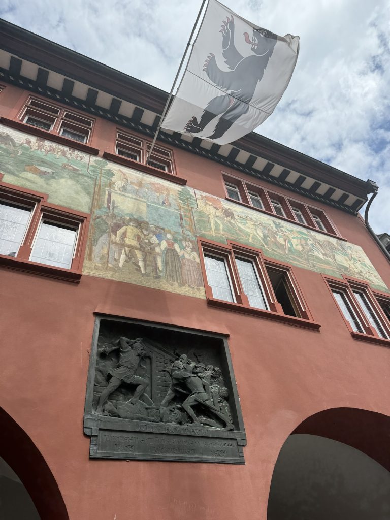
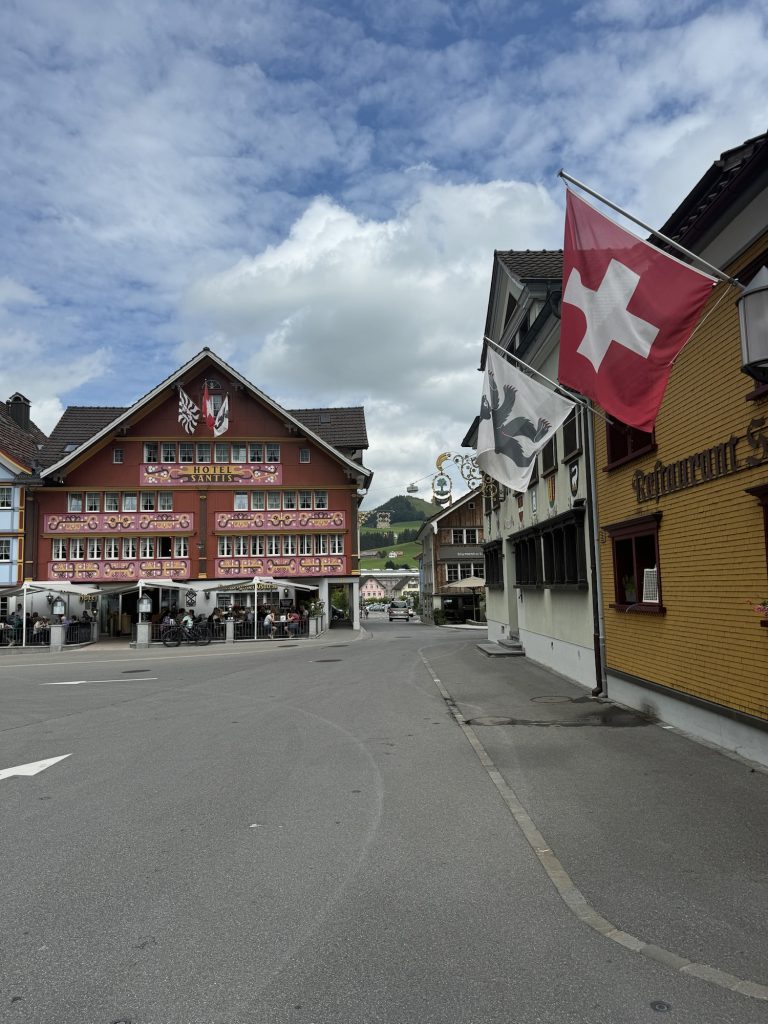
Appenzell: A Textbook Swiss Town
Back in the valley, I went with the bus back to the Urnäsch station to board the train further in the direction of Appenzell. Arrived there I visited this town which is the absolute textbook example of a cliché old Swiss town. Many old decorated houses, an official shop of the famous Appenzell cheese, and, most important for me, a very nice old town hall which allowed me to take my 25th canton parliament selfie. Now there’s only the town hall of Bern missing, which I’ve been to, but before I started the challenge. So, as of now, I can really say that I have indeed visited all of Switzerland’s 26 cantons.
Having spent some time in this very lovely town, it was time to go home. In Appenzell I boarded the same tram/train which already brought me to my youth hostel in St. Gallen last night. Here it doesn’t run on the road like in St. Gallen, but on its own tracks. In St. Gallen I boarded the Intercity 5 which brought me directly to the shores of Lac Leman, giving me enough time to write this blog post.
This journey through Appenzell once again showcased the incredible diversity and efficiency of Swiss infrastructure. From normal gauge trains to metric gauge tracks, from buses navigating mountain roads to cable cars ascending to breathtaking heights – all seamlessly connected and timed to perfection. It’s a testament to Swiss engineering and planning, making even the most remote corners of this beautiful country accessible to all.